Verwaiste Dateien
Aus FOSSGIS Wiki
Zur Navigation springenZur Suche springen
Bitte beachte, dass andere Webseiten eine Datei mit einer direkten URL verlinken können. Sie könnte daher hier aufgelistet sein, obwohl sie in aktiver Verwendung ist.
Unten werden bis zu 391 Ergebnisse im Bereich 1 bis 391 angezeigt.
 Fossgis2006.gif 121 × 121; 3 KB
 Fossgis konferenz logo.png 135 × 135; 6 KB
 Fossgis2010.png 250 × 250; 13 KB
 GvSIG Intergeo09.pdf ; 4,69 MB
- InsideBiosphere3D SteffenErnst.pdf ; 1,21 MB
- Geops wmsperformance 090922.pdf ; 2,26 MB
- Intergeo20090922 ILWIS.pdf ; 1,31 MB
- 52N OSPark drewnak.pdf ; 930 KB
- Mapbender on intergeo2009 de.pdf ; 1.008 KB
- 2009 09 OSP-IntergeoAT.pdf ; 1,37 MB
- WebSIG-MapFish presentation DEU.pdf ; 7,76 MB
- Igeodesktop intergeo 2009.pdf ; 1,46 MB
- Intergeo2009 FOSSGIS 1024x768.pdf ; 1,91 MB
- RollUp druckvorstufe final.pdf ; 3,86 MB
- Programm intergeo2010.pdf ; 387 KB
 OSGeo-Park INTERGEO 2011 Model.png 792 × 842; 61 KB
- Programm intergeo2011.pdf ; 66 KB
 Karte.png 64 × 64; 7 KB
 Metaspatial 200px.png 200 × 34; 5 KB
 Hier koennte ihr logo stehen.png 116 × 37; 7 KB
 Omniscale logo 4c cymk.png 200 × 40; 11 KB
 Gbd-fossgis 116px.png 116 × 42; 11 KB
 MapMedia Logo 116px.png 116 × 20; 5 KB
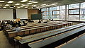
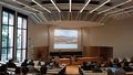
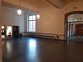
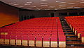 UBA Hoersaal 340.JPG 3.456 × 1.944; 1,01 MB
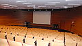 UBA Hoersaal.JPG 3.456 × 1.944; 1.009 KB
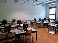
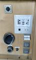
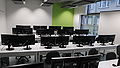 WSRaum1 16Plaetze.JPG 3.456 × 1.944; 904 KB
 WSRaum2 16Plaetze.JPG 3.456 × 1.944; 880 KB
 LocalTeam.JPG 3.456 × 1.944; 1,17 MB
 LocalTeam UBA.JPG 3.456 × 1.944; 1,36 MB
 Gebaeude4 Ausstellerflaeche unten.JPG 3.456 × 1.944; 1.010 KB
 Gebaeude4 von Ausstellerflaeche zu WC.JPG 1.944 × 3.456; 858 KB
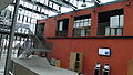
 Gebaeude4 Flaeche.JPG 3.456 × 1.944; 984 KB
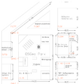
 30 2.png 1.748 × 983; 2,27 MB
 Gebaeude4 Ausstellerflaeche unten2.JPG 1.944 × 3.456; 1,03 MB
 Seminarplatz1.JPG 3.456 × 1.944; 1,1 MB
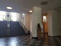
 Rezeptionsstandort.JPG 1.944 × 3.456; 837 KB
 Aquarium Gebaeude8 Projektstandflaeche.JPG 3.456 × 1.944; 1,05 MB
 Logo-camptocamp 116px.png 166 × 119; 13 KB
 52n logo 230x83.png 230 × 83; 14 KB
 MapMedia Logo 230x40.png 230 × 40; 17 KB
 Camptocamp logo 116x83.png 116 × 83; 9 KB
 Hoersaal 04114 Gebaeude4.JPG 3.456 × 1.944; 833 KB
 Gebaeude4 Posterflaeche oben.JPG 3.456 × 1.944; 1,02 MB
 Hoersaal Gebaeude8.JPG 3.456 × 1.944; 1,12 MB
 Aquarium Gebaeude8.JPG 3.456 × 1.944; 1,07 MB
 Disy logo 200x75.png 200 × 72; 7 KB
- Entwurf Fragebogen2011.pdf ; 519 KB
 Geops logo 270x70.png 250 × 65; 20 KB
 BeMasterGIS logo 190x101.jpg 190 × 101; 11 KB
 Geofabrik-Logo 10k Quadratpixel.png 207 × 48; 9 KB
 Logo fossacademy 200x47.png 200 × 47; 4 KB
 Logo wheregroup 270x71px.png 270 × 71; 11 KB
 Logo einfarbig 100x100.png 100 × 100; 7 KB
 Imr logo 185 106.png 185 × 106; 18 KB
 Mapwebbing logo 200x28px.png 198 × 27; 6 KB
 Gebaeude 2.PNG 1.748 × 983; 2,92 MB
 Geb2 innen.jpg 3.264 × 2.448; 401 KB
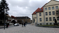
 Geb2 aussen.jpg 3.264 × 1.591; 469 KB
- Fehler beim Erstellen des Vorschaubildes: Datei mit Abmessungen größer als 12,5 MPTasche Design.png 3.775 × 4.255; 1,72 MB
 Fossgis2008 freiburg.jpg 2.816 × 2.112; 1,6 MB
- Parkmöglichkeiten A4.pdf ; 194 KB
 Wichmann Logo 200px.PNG 200 × 40; 9 KB
- Amtsblatt Nr 03 Maerz 2012.pdf ; 4,06 MB
- Poster final a3.pdf ; 1,27 MB
- Layers-final.pdf ; 38 KB
- Back 04 white-bg.pdf ; 30 KB
 Fossgis12-logo c9.png 644 × 644; 32 KB
 12 2.png 1.748 × 983; 2,37 MB
- Entwurf workshop2012.pdf ; 72 KB
 Test.qq.zip ; 136 Bytes
- Fossgis template tagungsband.zip ; 45 KB
- TN-Mail FOSSGIS2012.odt ; 20 KB
- 2012-02-16-pm fossgis.pdf ; 418 KB
- Lageplan HS-Anhalt.pdf ; 235 KB
 Stadtplanausschnitt Dessau FOSSGIS 2012.png 894 × 632; 571 KB
- TN-Mail FOSSGIS2012 v2.odt ; 7 KB
- FossGIS Seite.zip ; 76 KB
- Liste Tascheninhalt 2012.odt ; 16 KB
- Geoportal-de FOSSGIS 2012 knopp.pdf ; 2,54 MB
- Teilnahmebescheinigung Vorlage.odt ; 1,2 MB
- PostGIS 2.0 Emde FOSSGIS 2012.pdf ; 2,76 MB
- PostGIS 2.0 Emde FOSSGIS 2012 WS.pdf ; 2,77 MB
- CfL FOSSGIS2013 EntwurfV1.odt ; 103 KB
- CfL FOSSGIS2013 EntwurfV3.pdf ; 103 KB
- Vorschlag PM CfL 2013.odt ; 918 Bytes
- CfL FOSSGIS 2013.pdf ; 102 KB
 Fossgis12-logo neu ohneRand.png 284 × 284; 21 KB
- Example.pdf ; 1,63 MB
- Flyer FOSSGIS 2013 v1.odg ; 7,4 MB
- Flyer FOSSGIS 2013 v2.odg ; 7,44 MB
- OSGeo DVD Vorstellung.odp ; 814 KB
- Intergeo 2012 mapproxy.pdf ; 2,59 MB
- Deegree-inspire-wmts.pdf ; 638 KB
- Was-ist-open-data.pdf ; 716 KB
- 2012-10-10 earthserver.pdf ; 1,45 MB
- 2012-10-09 standards.pdf ; 1,76 MB
- 2012-10-09 Intergeo-rasdaman.pdf ; 1,17 MB
- Imposm-intergeo-2012.pdf ; 3,45 MB
 Fossgis2013.png 517 × 706; 506 KB
- Flyer FOSSGIS 2013 v3.odg ; 651 KB
- Flyer FOSSGIS 2013 v3.pdf ; 3,08 MB
 OSGeo Live 6.5 booklet outside bleeding.png 3.863 × 2.000; 3,88 MB
- CfL FOSSGIS 2014 Entwurf V1.odt ; 51 KB
 Schluesselbaendel HSR.png 1.024 × 768; 1,14 MB
 HSR Logo RGB 72.jpg 767 × 300; 84 KB
 SOSM logo small.png 160 × 45; 8 KB
- Fehler beim Erstellen des Vorschaubildes: Datei mit Abmessungen größer als 12,5 MPHSR Logo quadratisch.png 4.000 × 4.000; 196 KB
- Workshop.zip ; 1,42 MB
- FOSSGIS 2013 OSGeo-Live rocks AEmde.pdf ; 2,11 MB
- Workshop PostGIS 2 Emde FOSSGIS 2013.pdf ; 1,38 MB
- MATSim-Vortrag-Zilske.pdf ; 4,14 MB
- Kassenprüfungsbericht 2012.pdf ; 80 KB
- INTERGEO 2013 OS Park Standplan.pdf ; 1,88 MB
- OS Park Standplan.pdf ; 204 KB
 Till chambord.jpg 480 × 360; 50 KB
- CfL FOSSGIS 2015.odt ; 66 KB
- EnviroCar Intergeo 2013.pdf ; 2,2 MB
- Mapproxy intergeo 2013.pdf ; 2,84 MB
- Imposm-intergeo-2013.pdf ; 3,12 MB
- Intergeo 2013 ALKIS norBIT GmbH.pdf ; 779 KB
- IMR-RFUE-WebGIS-Intergeo-2013-v3.pdf ; 9,21 MB
- Praesentation b3d terrestris.pdf ; 8,18 MB
- Qgis cloud de.pdf ; 921 KB
- Fms.pdf ; 560 KB
- Qgis enterprise.pdf ; 95 KB
- Intergeo orka 2013.pdf ; 4,53 MB
- 2013-10-09 INTERGEO-OSGeo-rasdaman.pdf ; 1,81 MB
- Intergeo 2013 werraenergie.pdf ; 4,21 MB
- Poster FOSSGIS-2014 CfP.pdf ; 1,04 MB
 FOSSGIS-Logo-ohne-Rand.PNG 961 × 961; 92 KB
- Flyer FOSSGIS 2014.odg ; 703 KB
- Flyer FOSSGIS 2014.pdf ; 260 KB
 Anmeldebutton.png 280 × 40; 6 KB
 FOSSGIS2014 Tweets.jpg 1.187 × 976; 386 KB
 Twitter bird.svg ; 2 KB
 OSRM-Icon.png 48 × 48; 3 KB
 52n.png 167 × 60; 5 KB
- FOSSGIS 2015 CfP Poster 2014.pdf ; 1,73 MB
 Sent.png 1.220 × 687; 1,54 MB
 Sent .png 1.220 × 687; 1,32 MB
- 2008 fossgis tagungsband.pdf ; 7,33 MB
- 2009 fossgis tagungsband.pdf ; 4,42 MB
- 2011 fossgis tagungsband.pdf ; 6,67 MB
- 2012 fossgis tagungsband 150dpi.pdf ; 7,95 MB
- 2014 fossgis tagungsband ebook.pdf ; 5,55 MB
- 2010 fossgis tagungsband ebook.pdf ; 6,68 MB
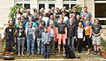
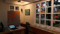
 2 FOSSGIS Hacking Januar 2015 Gruppenfoto.jpg 1.024 × 680; 310 KB
 Openjump telescope.jpg 600 × 800; 60 KB
 TN-Anmeldung 20150114.png 1.085 × 507; 217 KB
 Vorschau Tasche.PNG 576 × 426; 35 KB
- 2015 fossgis tagungsband.pdf ; 8,35 MB
 Flyer FOSSGIS 2016 Entwurf 20150529.png 1.550 × 563; 152 KB
- Protokoll MV 2015 Muenster.pdf ; 51 KB
- Protokoll MV 2015 Essen.pdf ; 49 KB
- Fehler beim Erstellen des Vorschaubildes: Datei mit Abmessungen größer als 12,5 MPFossgis16-logo.png 4.332 × 4.332; 118 KB
 Grillbuffetx.png 435 × 307; 271 KB
 Foss4g2016 postcard.jpg 433 × 316; 43 KB
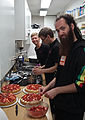 Erdbeerkuchen 3 FOSSGIS-Hacking.jpg 574 × 812; 95 KB
 600px-FossgisOSMSommercamp.jpg 600 × 352; 100 KB
 Foss4ge.png 100 × 93; 12 KB
 FOSS4GE2015.jpg 600 × 130; 40 KB
 FOSS4GE2015 Gfoss.it.jpg 600 × 339; 98 KB
 FOSS4GE2015 FOSS4G2015Seoul.jpg 500 × 249; 57 KB
 FOSS4GE2015 MayTheFOSSBeWithYou.jpg 600 × 399; 77 KB
 FOSS4GE2015 ianturton.jpg 600 × 389; 83 KB
 FOSS4GE2015 CodeSprint.jpg 600 × 338; 115 KB
- 20150915 qgis28-212 intergeo.pdf ; 2,69 MB
 INTERGEO 2015 OSGeo Park Standparty.jpg 3.264 × 1.836; 1,5 MB
 Astrid-Emde-Vortrag-Mapbender-0995.jpg 4.302 × 2.860; 2,45 MB
 CartoDB-0011.jpg 4.302 × 2.860; 2,84 MB
 ISB-AG-Intergeo-2015-0008.jpg 4.302 × 2.860; 2,72 MB
 Olaf Knopp Vortrag Meldemax 0999.jpg 4.302 × 2.860; 2,17 MB
 Sourcepole-0998.jpg 4.302 × 2.860; 2,92 MB
 Spielwiese-W-0996.jpg 4.302 × 2.860; 2,8 MB
 Spielwiese-W-0997.jpg 4.302 × 2.860; 2,91 MB
 Wheregroup-1-0009.jpg 4.302 × 2.860; 2,67 MB
- Raeume FOSSGIS2016.pdf ; 1,13 MB
- Wien Wappen.svg ; 694 Bytes
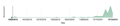
 Statistik Grafik 9Wochenvorher 20160503.PNG 2.743 × 1.261; 433 KB
- Schmankerlbuffet 2016.pdf ; 61 KB
- Programm FOSSGIS-2016.pdf ; 120 KB
 FOSSGIS2016 OSGeo-live Workshop.jpg 3.264 × 1.836; 1,56 MB
 FOSSGIS2016 OSGeo FOSSGIS OSM Stand.jpg 3.264 × 1.836; 1,4 MB
 FOSSGIS2016 Pause.jpg 3.264 × 1.836; 1,67 MB
 FOSSGIS2016 Empfang.jpg 3.264 × 1.836; 1,63 MB
 FOSSGIS2016 Interviews mit Videoteam.jpg 3.264 × 1.836; 1,53 MB
 FOSSGIS2016 booklet.jpg 1.836 × 3.264; 1,64 MB
 Fossgis pin.jpg 500 × 251; 223 KB
 SMTP.png 1.065 × 709; 74 KB
 Tmp 25288-20170121 1436451162618525.jpg 3.264 × 1.836; 1,73 MB
 Fossgis17-logo klein.PNG 162 × 162; 13 KB
- Fragebogen2017.pdf ; 382 KB
- Jahresbericht MV 2017.pdf ; 94 KB
 IMG 0037 klein.jpg 2.726 × 775; 1,67 MB
 Fossgis2017 eroefgnung1.jpg 3.264 × 1.836; 1,7 MB
 Fossgis2017 mediasponspr.jpg 3.264 × 1.836; 1,23 MB
 Fossgis2017 Zeitungsartikel.jpg 3.264 × 1.836; 1,52 MB
 Tmp 17576-20170323 1545201933291355.jpg 3.264 × 1.836; 1,66 MB
 Tmp 17576-20170323 171841559206629.jpg 3.264 × 1.836; 1,3 MB
 Fossgis2017 wprkshop osgeolive.jpg 3.264 × 1.836; 1,45 MB
 Tmp 17576-20170324 1647311671352087.jpg 1.836 × 3.264; 1,81 MB
 Tmp 17576-20170324 174538313001009.jpg 3.264 × 1.836; 1,92 MB
 Tmp 17576-20170324 1446061038217362.jpg 3.264 × 1.836; 1,49 MB
- Sotm japan logo-dark.svg ; 31 KB
 Flyer FOSSGIS 2018 Entwurf 20170623.png 2.605 × 924; 1,19 MB
 Av portal.png 1.295 × 747; 201 KB
 Intergeo Hamburg 2017 EN logo.png 420 × 70; 28 KB
- INTERGEO 2017 Stand 2017.1305 04-A1.pdf ; 1,72 MB
- Osgeo-park-intergeo-2017.pdf ; 1,43 MB
- Arbeitspakete FOSSGIS 2018.odt ; 21 KB
 Intergeo 2017-Kaffeeecke 1.jpg 4.206 × 2.805; 1,5 MB
 Intergeo 2017-Kaffeeecke 2.jpg 4.288 × 2.848; 1,7 MB
 Intergeo 2017-Kaffeetheke.jpg 4.288 × 2.848; 1,37 MB
 Intergeo 2017-OSM-Einfuehrungsvortrag 1.jpg 4.288 × 2.848; 1,83 MB
 Intergeo 2017-OSM-Einfuehrungsvortrag 2.jpg 4.288 × 2.848; 1,34 MB
 Intergeo 2017-Stand von links.jpg 4.288 × 2.848; 1,82 MB
 Intergeo 2017-Stand von rechts.jpg 2.848 × 4.288; 1,77 MB
 Intergeo 2017-Stand von vorn.jpg 4.288 × 2.848; 1,88 MB
 Intergeo 2017-Stand von vorn links.jpg 4.288 × 2.848; 1,89 MB
- CfL FOSSGIS-2019.pdf ; 212 KB
 20171208 213803.jpg 3.264 × 1.836; 1,24 MB
 20171208 214442.jpg 3.264 × 1.836; 1,51 MB
 20171208 214431.jpg 3.264 × 1.836; 1,17 MB
 20171209 160749.jpg 1.836 × 3.264; 1,54 MB
 20171209 113808.jpg 3.264 × 1.836; 1,34 MB
 20171209 160800.jpg 3.264 × 1.836; 1,52 MB
 20171209 163139.jpg 3.264 × 1.836; 1,67 MB
 P1150467 MartinA.jpg 250 × 314; 14 KB
 Paule.jpeg 1.071 × 795; 146 KB
 Intergeo2018 standuebersicht.png 855 × 577; 237 KB
- FOSSGIS-2018-1.33.5.apk.zip ; 1,91 MB
- Fehler beim Erstellen des Vorschaubildes: Datei fehltFOSSGIS 2018 Bonn Gruppenfoto.jpg 1.181 × 787; 1,28 MB
 Flyer FOSSGIS 2019 Entwurf 20180617 rück.png 906 × 643; 669 KB
 Postkarte Seite1 v2.jpg 1.752 × 1.244; 166 KB
 Postkarte Seite2 v1.png 1.750 × 1.242; 1,14 MB
 FOSSGIS 2019 Postkarte Seite2 v2.jpg 1.750 × 1.242; 530 KB
 FOSSGIS 2019 Postkarte Seite1 v3.jpg 1.752 × 1.244; 251 KB
 FOSSGIS 2019 Postkarte Seite2 v3.jpg 1.750 × 1.242; 492 KB
 Fossgis19-logo.png 1.785 × 1.785; 140 KB
 Z208 HTWDD.jpg 3.000 × 2.250; 587 KB
 Foyer Audimax HTWDD.jpg 3.900 × 2.925; 870 KB
 Zentralgebaeude Foyer HTWDD.jpg 2.800 × 2.100; 543 KB
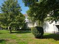 Mensagebauede Wiese.jpg 2.800 × 2.100; 1,75 MB
 Sotm.jpg 800 × 499; 45 KB
- INTERGEO 2018 Halle 12.1.pdf ; 937 KB
 FOSSGIS Hacking 3.jpg 1.280 × 720; 121 KB
 20181124 125535 grosser Seminarraum.jpg 1.979 × 1.484; 407 KB
- Aufkleber 6eck.svg ; 17 KB
- 2 Aufkleber 6eck 2018-02-06.pdf ; 1,62 MB
- 1 Aufkleber 6eck zweifarbdruck.pdf ; 1,64 MB
 2019-Poster A3-Neu.png 842 × 1.133; 131 KB
- 2019-Poster A3.pdf ; 152 KB
- Tasche.pdf ; 25 KB
- Fehler beim Erstellen des Vorschaubildes: Datei mit Abmessungen größer als 12,5 MP2019-02-07 Poster2019 A3.png 3.508 × 4.717; 694 KB
- 2 Aufkleber 6eck Einfarbdruck.pdf ; 1,62 MB
- 3 Aufkleber 6eck Einfarbdruck.pdf ; 1,61 MB
- Tasche V2.pdf ; 25 KB
 Poster2019 A3.png 1.754 × 2.359; 527 KB
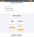
 Workshops freie Plätze.png 1.330 × 844; 261 KB
- Poster2019 A3.pdf ; 177 KB
- 2019-02-27a Poster2019 A3.pdf ; 177 KB
- 2019-02-07 Poster2019 A3.pdf ; 177 KB
 PAB Planung Aussteller zugeordnet wiki.jpg 1.632 × 988; 538 KB
- Jahresbericht MV 2019.pdf ; 93 KB
- Finanzbereicht 2018.pdf ; 47 KB
- Diversity im FOSSGIS.pdf ; 192 KB
 FOSSGIS Sommercamp 2019 - 9423.jpeg 2.800 × 1.867; 1,93 MB
 Entwurf Stefan Schulze HTW halberKompass2020.png 1.510 × 1.166; 699 KB
 Entwurf TS FOSSGIS2020 B1.png 1.526 × 804; 76 KB
 Entwurf TS FOSSGIS2020 B2.png 1.254 × 804; 72 KB
 Entwurf TS FOSSGIS2020 B3.png 1.462 × 1.012; 93 KB
 Entwurf Stefan Schulze HTW KompassRand.png 717 × 274; 44 KB
 Entwurf Stefan Schulze HTW halberKompass.png 557 × 274; 36 KB
 Fossgis2020 logo kompass v2 invertiert.png 787 × 334; 41 KB
 Fossgis2020 logo halber kompass v2 grau.png 557 × 274; 37 KB
 Fossgis2020 logo halber kompass v2 invertiert.png 621 × 334; 33 KB
 Fossgis2020 logo kompass v2 grau.png 717 × 274; 45 KB
 Fossgis 2020 logo.png 3.003 × 2.321; 380 KB
 FOSSGIS2020 Hörsaal-Weissmannhaus 02.jpg 567 × 944; 161 KB
 FOSSGIS2020 Workshopraum R113 01.jpg 1.220 × 610; 287 KB
- Angebot catering SWRFR.PDF ; 1,91 MB
- Sponsorenheft-v07.pdf ; 2,21 MB
 Screenshot 2019-11-18 at 13.56.01.png 1.484 × 316; 38 KB
 105 kuestenschmiede.png 1.000 × 282; 18 KB
- Konferenzfragebogen 2020.pdf ; 44 KB
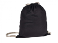 Beutel Variante1 2-39EUR.png 453 × 340; 87 KB
 FOSSGIS Konferenz Logo 2021.png 1.779 × 1.779; 101 KB
 FOSSGIS Update-Logo V6.png 285 × 122; 31 KB
 FOSSGIS Update-Logo V5.png 312 × 125; 24 KB
 FOSSGIS Update-Logo V3.png 155 × 181; 27 KB
- Sponsoreninformationen FOSSGIS-2021.pdf ; 1,12 MB
 FOSSGIS-UPDATE Website 1.png 1.029 × 278; 58 KB
 FOSSGIS-UPDATE Website 4.png 785 × 856; 62 KB
 FOSSGIS-UPDATE Website 2.png 832 × 804; 353 KB
 FOSSGIS-UPDATE Website 3.png 816 × 844; 154 KB
 Netzwerkwelt FOSSGIS-UPDATE.png 1.180 × 1.169; 246 KB
- Onbording FOSSGIS-Konferenz.pdf ; 1,03 MB
- Anleitung zwei speaker obs ninja.pdf ; 1,06 MB
 Marburg DSA Seminarraum 03.JPG 2.048 × 1.536; 563 KB
 Marburg DSA Seminarraum 04.JPG 2.048 × 1.536; 550 KB
 Marburg DSA Seminarraum 06.JPG 2.048 × 1.536; 610 KB
 Marburg DSA Seminarraum 08 PCs.JPG 2.048 × 1.536; 598 KB
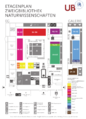 210817 Etagenuebersicht NAWI Berlin dt.png 760 × 1.055; 271 KB
 2022-11-26-PKO-FOSSGIS2023.png 1.240 × 920; 1 MB
- Lsmandat.pdf ; 40 KB
 Statistik FOSSGIS2023 2023 01 16.png 945 × 363; 171 KB
- Bike.svg ; 2 KB
 WS-Statistik FOSSGIS2023 2023 01 16.png 945 × 439; 130 KB
 502 voc square.png 900 × 900; 25 KB
- Fossgis-konferenz-loc.pdf ; 52 KB
- Fossgis-konferenz-details.pdf ; 60 KB
 FOSSGIS Logo.png 2.759 × 811; 178 KB
 FOSSGIS Logo RGB sw1 100x45mm 600dpi.png 2.362 × 827; 93 KB
 Email-Sign Bild.png 945 × 171; 96 KB
 FOSSGIS2024 Studieblock Social Media.png 756 × 425; 544 KB
- 1459070.svg ; 831 Bytes
- Test.svg ; 1 KB
- Elphi RGB keine links.svg ; 9 KB


